
















Weather Alerts
Severe Weather Alert: A Tornado Watch remains in effect for Cannon County until 9 PM CDT. This is a critical and potentially dangerous situation. Stay vigilant and ready to take action. If you are in a mobile home or temporary shelter, find a sturdy building nearby. Expect potential for dangerous flying debris and significant damage to structures.
Safety Instructions: Move to the lowest interior room of a sturdy building or seek shelter in a basement. Avoid windows and prepare for possible rapid weather changes. Keep your phone charged for timely updates!
Current Weather
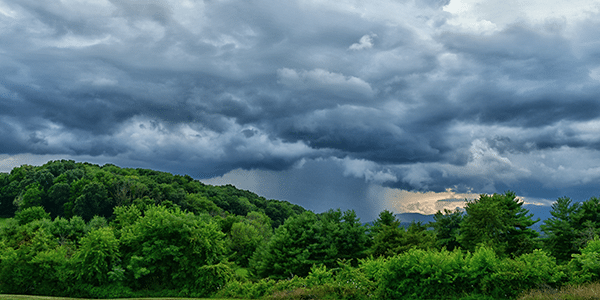
It’s currently 4:45 AM in Cannon County, TN, with temperatures holding steady at 59°F. Humidity is high, at 88%, giving the air a damp, heavy feel, making it seem a touch warmer than it is. Winds are calm right now, but the atmosphere is charged, and you can feel the tension of the approaching storm as if the world is holding its breath.
Weather Changes Coming
Be alert for a fast and potentially severe shift in weather conditions as the day progresses. Storm systems are moving in, and the calm will soon give way to strong winds and turbulent weather. Expect to feel the temperature drop slightly as winds pick up, which will make the already humid air feel even tougher to breathe. Keep an eye out for increased thunder activity; it could turn intense in moments.
Tonight’s Forecast
As we move through the day, hanging clouds will deepen, and rain is likely to start falling, heavy at times. Persistent rainfall of up to 4 inches in some localized areas is possible, especially as evening approaches. In the midst of this spring storm, expect temperatures to hover in the high 50s and low 60s. The combination of increased winds and rain will create a raw, damp feeling outdoors. Be prepared if you need to head outside; wear appropriate rain gear and stay cautious of slick roads as nighttime visibility decreases.
L:51°


24-Hour Forecast

|
30°

|
37°
|
49°
|
37°
|
30°
|
41°


Subscribe to our FREE Newsletter