
















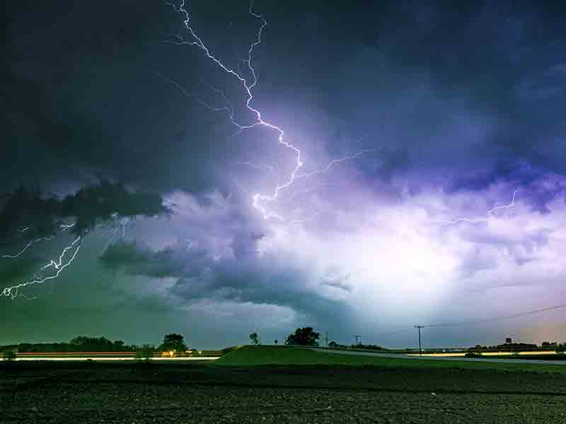
Severe Thunderstorm Watch
THE NATIONAL WEATHER SERVICE HAS ISSUED SEVERE THUNDERSTORM WATCH
209 IN EFFECT UNTIL 5 PM CDT THIS AFTERNOON FOR THE FOLLOWING
AREAS
IN TENNESSEE THIS WATCH INCLUDES 38 COUNTIES
IN MIDDLE TENNESSEE
BEDFORD CANNON CHEATHAM
CLAY COFFEE CUMBERLAND
DAVIDSON DE KALB DICKSON
FENTRESS GILES GRUNDY
HICKMAN HOUSTON HUMPHREYS
JACKSON LAWRENCE LEWIS
MACON MARSHALL MAURY
MONTGOMERY OVERTON PERRY
PICKETT PUTNAM ROBERTSON
RUTHERFORD SMITH STEWART
SUMNER TROUSDALE VAN BUREN
WARREN WAYNE WHITE
WILLIAMSON WILSON
THIS INCLUDES THE CITIES OF ALLARDT, ALTAMONT, ASHLAND CITY,
BRENTWOOD, BYRDSTOWN, CARTHAGE, CELINA, CENTERVILLE, CLARKSVILLE,
CLIFTON, COALMONT, COLLINWOOD, COLUMBIA, COOKEVILLE, CROSSVILLE,
DICKSON, DOVER, ERIN, FRANKLIN, GAINESBORO, GALLATIN,
GOODLETTSVILLE, GORDONSVILLE, HARTSVILLE, HENDERSONVILLE,
HOHENWALD, JAMESTOWN, KINGSTON SPRINGS, LA VERGNE, LAFAYETTE,
LAWRENCEBURG, LEBANON, LEWISBURG, LINDEN, LIVINGSTON, LOBELVILLE,
MANCHESTER, MCEWEN, MCMINNVILLE, MOUNT JULIET, MURFREESBORO,
NASHVILLE, NEW JOHNSONVILLE, PALMER, PEGRAM, PULASKI,
SHELBYVILLE, SMITHVILLE, SMYRNA, SOUTH CARTHAGE, SPARTA, SPENCER,
SPRINGFIELD, TENNESSEE RIDGE, TULLAHOMA, WAVERLY, WAYNESBORO,
AND WOODBURY.
Weather Alerts
Attention, Cannon County! The National Weather Service has issued a Severe Thunderstorm Watch, active until 5 PM CDT today. Conditions are being monitored closely, and it’s important to stay weather aware. Keep tuned for updates, and make sure you have your safety plans in place.
Current Weather: Severe Weather Warning
It’s currently 12:10 PM in Cannon County, TN, with the temperature at a warm 68°F. However, don’t let that fool you—severe weather is brewing as the air feels thick with humidity at 88%, contributing to an atmosphere that’s charged and ready for action. Winds are calm right now, but that’s likely to change with incoming storms. The sky is a mix of ominous clouds, casting a grayish hue, hinting at what’s to come.
Weather Changes Coming
Prepare for significant shifts in conditions as the afternoon unfolds. With increasing moisture in the air, the humidity will make it feel warmer than the actual temperature; you might notice it becoming more oppressive as the day progresses. Be ready for possible strong winds ahead, which could whip through, making standing outside feel less comfortable. As storms develop, expect the temperature to fluctuate, providing a stark contrast to the comfortable warmth you felt earlier.
Tonight’s Forecast
As we move into the evening, the weather will continue to evolve. Stay alert for thunderstorms, which may bring heavy rain and potentially damaging winds. If you have plans outside, you may want to rethink them, as conditions will be unpredictable. Be prepared for cooler temperatures as the rain moves in, dropping into the lower 60s, and with moisture in the air, it could feel a touch chillier. Stay safe and monitored—tonight could be one for the weather books!
L:60°


24-Hour Forecast

|
60°
|
51°
|
47°

|
47°
|
56°
|
57°
|
56°


Subscribe to our FREE Newsletter