















Tornado Watch
THE NATIONAL WEATHER SERVICE HAS ISSUED TORNADO WATCH 107 IN
EFFECT UNTIL 10 PM CDT THIS EVENING FOR THE FOLLOWING AREAS
IN TENNESSEE THIS WATCH INCLUDES 31 COUNTIES
IN MIDDLE TENNESSEE
BEDFORD CANNON CHEATHAM
CLAY DAVIDSON DE KALB
DICKSON FENTRESS GILES
HICKMAN HOUSTON HUMPHREYS
JACKSON LAWRENCE LEWIS
MACON MARSHALL MAURY
MONTGOMERY OVERTON PERRY
PICKETT PUTNAM ROBERTSON
RUTHERFORD SMITH SUMNER
TROUSDALE WAYNE WILLIAMSON
WILSON
THIS INCLUDES THE CITIES OF ALLARDT, ASHLAND CITY, BRENTWOOD,
BYRDSTOWN, CARTHAGE, CELINA, CENTERVILLE, CLARKSVILLE, CLIFTON,
COLLINWOOD, COLUMBIA, COOKEVILLE, DICKSON, ERIN, FRANKLIN,
GAINESBORO, GALLATIN, GOODLETTSVILLE, GORDONSVILLE, HARTSVILLE,
HENDERSONVILLE, HOHENWALD, JAMESTOWN, KINGSTON SPRINGS,
LA VERGNE, LAFAYETTE, LAWRENCEBURG, LEBANON, LEWISBURG, LINDEN,
LIVINGSTON, LOBELVILLE, MCEWEN, MOUNT JULIET, MURFREESBORO,
NASHVILLE, NEW JOHNSONVILLE, PEGRAM, PULASKI, SHELBYVILLE,
SMITHVILLE, SMYRNA, SOUTH CARTHAGE, SPRINGFIELD, TENNESSEE RIDGE,
WAVERLY, WAYNESBORO, AND WOODBURY.
Weather Alerts
The National Weather Service is actively monitoring the severe weather conditions affecting Cannon County. A Tornado Watch remains in effect until 10:00 PM CDT this evening. Residents are urged to stay weather aware and tuned to local updates as conditions develop throughout the evening.
Severe Weather Conditions
It’s currently 6:10 PM in Cannon County, TN, with temperatures sitting at 81°F amid a tense atmosphere of severe weather. The humidity is at 51%, which adds to the weight in the air—the kind that thickens with expectancy. Wind is calm, contributing to an eerie stillness, as if the outside world is holding its breath. The skies are overcast, lending a slightly ominous tone to the evening.
Weather Changes Coming
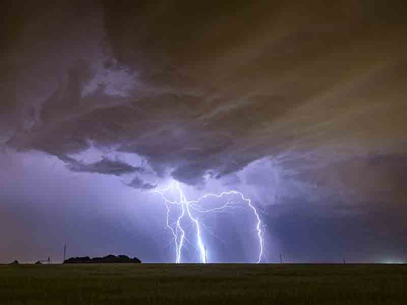
Keep a close watch—dramatic changes are on the horizon. Although it feels warm now, the weather is poised to take a turn, and with the watch in place, we could see intense storms bringing gusty winds and sudden temperature drops. The calm will soon give way to gusts that may feel sharper against your skin, with humidity making the air feel heavier as storms build. Expect the evening to shift rapidly as conditions evolve.
Tonight’s Forecast
As we move into the night, anticipate conditions to become increasingly unsettled. Expect potential thunderstorms with strong winds and the possibility of tornado activity, which could make stepping outside feel dangerous. Temperatures will likely drop as storms roll in, bringing cooler air overnight. Remain alert and prepared as the atmosphere shifts from a warm spring evening to a threatening stormy night. Stay safe and indoors if possible, and keep your eyes on the latest updates!
L:68°


24-Hour Forecast

|
68°
|
58°

|
41°
|
34°
|
32°
|
43°


Subscribe to our FREE Newsletter