
















Weather Alerts
Additionally, a **Wind Advisory** is in place until midnight tonight, with strong south winds reaching 15 to 25 mph and gusts up to 45 mph. These winds can cause unsecured objects to blow around, and may lead to downed tree limbs, resulting in power outages.
**Safety instructions:** Secure all outdoor items. Stay tuned to local forecasts for updates and be ready to act if flooding occurs. Check on those who may need assistance and avoid unnecessary travel in affected areas.
Current Weather
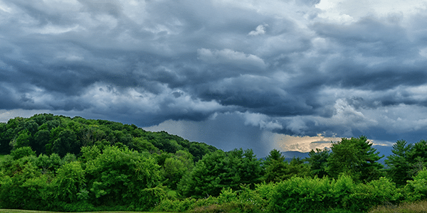
It’s currently 6:00 PM in Cannon County, TN. Temperatures are sitting at a warm 77°F, yet the air is thick with the promise of severe weather. At 36% humidity, it feels somewhat suffocating, as if the sky itself is bracing against the brewing storms. The winds stand still for now, offering no relief from the weighty atmosphere filled with tension.
The sky, though dimmed by the impending tempest, maintains a certain calm before a much-anticipated upheaval. Yet, that calm is deceptive, as weather conditions are poised to change rapidly.
Weather Changes Coming
A shift is approaching in more ways than one. As temperatures hover near 77°F, the balance will soon tip with the arrival of rain that will undoubtedly dampen vibrant springtime air. expect the warmth to be pushed aside by the moisture-filled clouds and strong winds sweeping in.
With forecasts hinting at strong gusts, the wind will add a chilly bite to the evening that doesn’t belong to this time of year—making it feel sharper than it should. Prepare for a distinct change in the evening’s fabric as temperature fluctuations and increased humidity combine for a night that could feel painfully damp.
Overnight and Tomorrow
Looking ahead to the nighttime hours, expect rain to move in after 10 PM, along with the onset of gusty winds. Temperatures will remain in the mid-70s initially, but will gradually cool as the storms intensify.
If you’re stepping outside, brace yourself for heavy downpours that may begin to arrive, especially after midnight. The wind will add an unsettling energy that may make it difficult to navigate in an open area—take care of belongings and be cautious if you’re out and about. Tomorrow will bear witness to the fallout of tonight’s storm, with lingering wet conditions and possible localized flooding.
Plan your routines accordingly, Cannon County; the weather is about to make quite an entrance.
L:60°


24-Hour Forecast

|
52°
|
32°

|
40°
|
50°
|
40°
|
31°


Subscribe to our FREE Newsletter