
















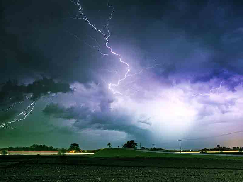
Tornado Watch
TORNADO WATCH 124 REMAINS VALID UNTIL 9 PM CDT THIS EVENING FOR
THE FOLLOWING AREAS
IN TENNESSEE THIS WATCH INCLUDES 34 COUNTIES
IN MIDDLE TENNESSEE
BEDFORD CANNON CHEATHAM
CLAY COFFEE DAVIDSON
DE KALB DICKSON GILES
HICKMAN HOUSTON HUMPHREYS
JACKSON LAWRENCE LEWIS
MACON MARSHALL MAURY
MONTGOMERY OVERTON PERRY
PUTNAM ROBERTSON RUTHERFORD
SMITH STEWART SUMNER
TROUSDALE VAN BUREN WARREN
WAYNE WHITE WILLIAMSON
WILSON
THIS INCLUDES THE CITIES OF ASHLAND CITY, BRENTWOOD, CARTHAGE,
CELINA, CENTERVILLE, CLARKSVILLE, CLIFTON, COLLINWOOD, COLUMBIA,
COOKEVILLE, DICKSON, DOVER, ERIN, FRANKLIN, GAINESBORO, GALLATIN,
GOODLETTSVILLE, GORDONSVILLE, HARTSVILLE, HENDERSONVILLE,
HOHENWALD, KINGSTON SPRINGS, LA VERGNE, LAFAYETTE, LAWRENCEBURG,
LEBANON, LEWISBURG, LINDEN, LIVINGSTON, LOBELVILLE, MANCHESTER,
MCEWEN, MCMINNVILLE, MOUNT JULIET, MURFREESBORO, NASHVILLE,
NEW JOHNSONVILLE, PEGRAM, PULASKI, SHELBYVILLE, SMITHVILLE,
SMYRNA, SOUTH CARTHAGE, SPARTA, SPENCER, SPRINGFIELD,
TENNESSEE RIDGE, TULLAHOMA, WAVERLY, WAYNESBORO, AND WOODBURY.
Additional Weather Alerts
-
Flood Watch
Flood Watch issued April 5 at 9:41AM CDT until April 6 at 7:00AM CDT by NWS Nashville TN
Weather Alerts
Attention, Cannon County residents! We are closely monitoring severe weather conditions in the area. Stay tuned for updates as the situation develops. It’s important to remain weather-aware, especially with a Tornado Watch and Flood Watch currently in effect. Ensure you have a plan in place should the conditions worsen.
Severe Weather Unleashed!
It’s currently 6:11 PM in Cannon County, TN, with temperatures at a warm 82°F, but don’t be fooled by the sunshine—severe weather is bearing down on us. The humidity sits at a moderate 45%, making the atmosphere feel thick, while calm winds provide little relief. The skies are an ominous mix of gray and dark, signaling potential storms that could erupt at any moment, so stay alert.
Weather Changes Coming
A pivotal shift is on the horizon. Temperatures may seem comfortable now, but as clouds gather and storms approach, prepare for that warmth to turn into an oppressive, heavy air punctuated by bursts of rain and wind. Expect an increase in winds that will summon a chill, making the evening feel more intense as the storms roll in.
Important Weather Alerts
Looking ahead, the next 24 hours promise a wild ride. More thunderstorms are on the way, leading to heavy rainfall that could saturate our already soaked ground. Flooding in lower areas is a real concern—be vigilant and ready to act if needed. The forecast is set to bring multiple rounds of showers, and conditions may worsen overnight into tomorrow. Let’s stay safe out there, Cannon County! Be prepared for a night of storms and heavy rain, and check those weather alerts regularly.
L:60°


24-Hour Forecast

|
41°

|
33°
|
32°
|
47°
|
48°
|
43°


Subscribe to our FREE Newsletter